Scottish Orienteering Championships 2017
The Scottish Orienteering Champs came to the Lothians for the first time, for a weekend of sun, sea and sand around Gullane on 20th-21st May 2017.
The Individual race took place at Gullane, Archerfield and Yellowcraig on the 20th of May 2017, organised by ESOC and TAY. Click for simple results and splits, WinSplits, string course, Routegadget for courses 1-16 and 17-18. Read more here.
The Relay took place in Binning Wood, hosted by INT. Click for simple results and splits, WinSplits, and Routegadget. Read more here.
The results and list of winners can be downloaded below.


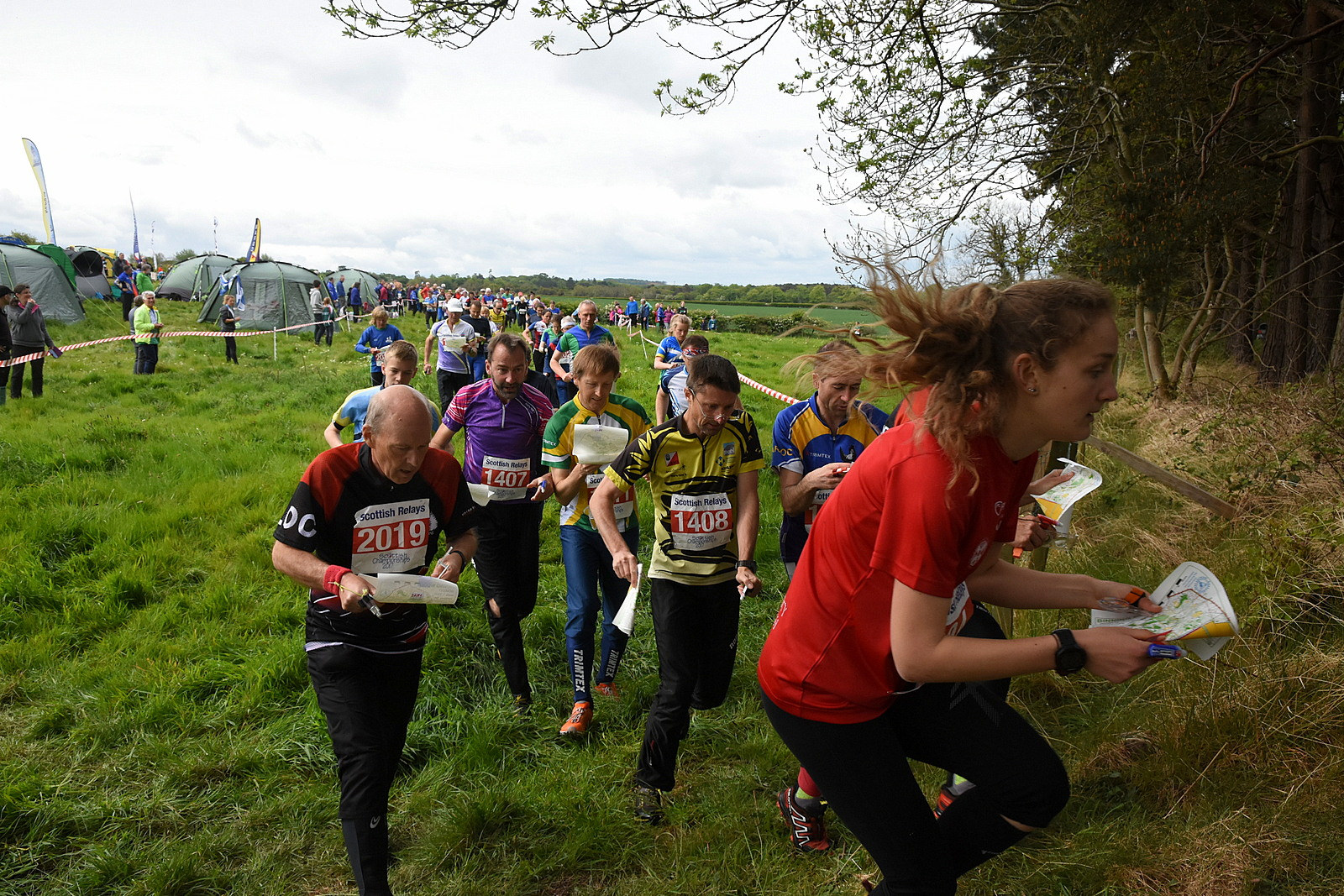


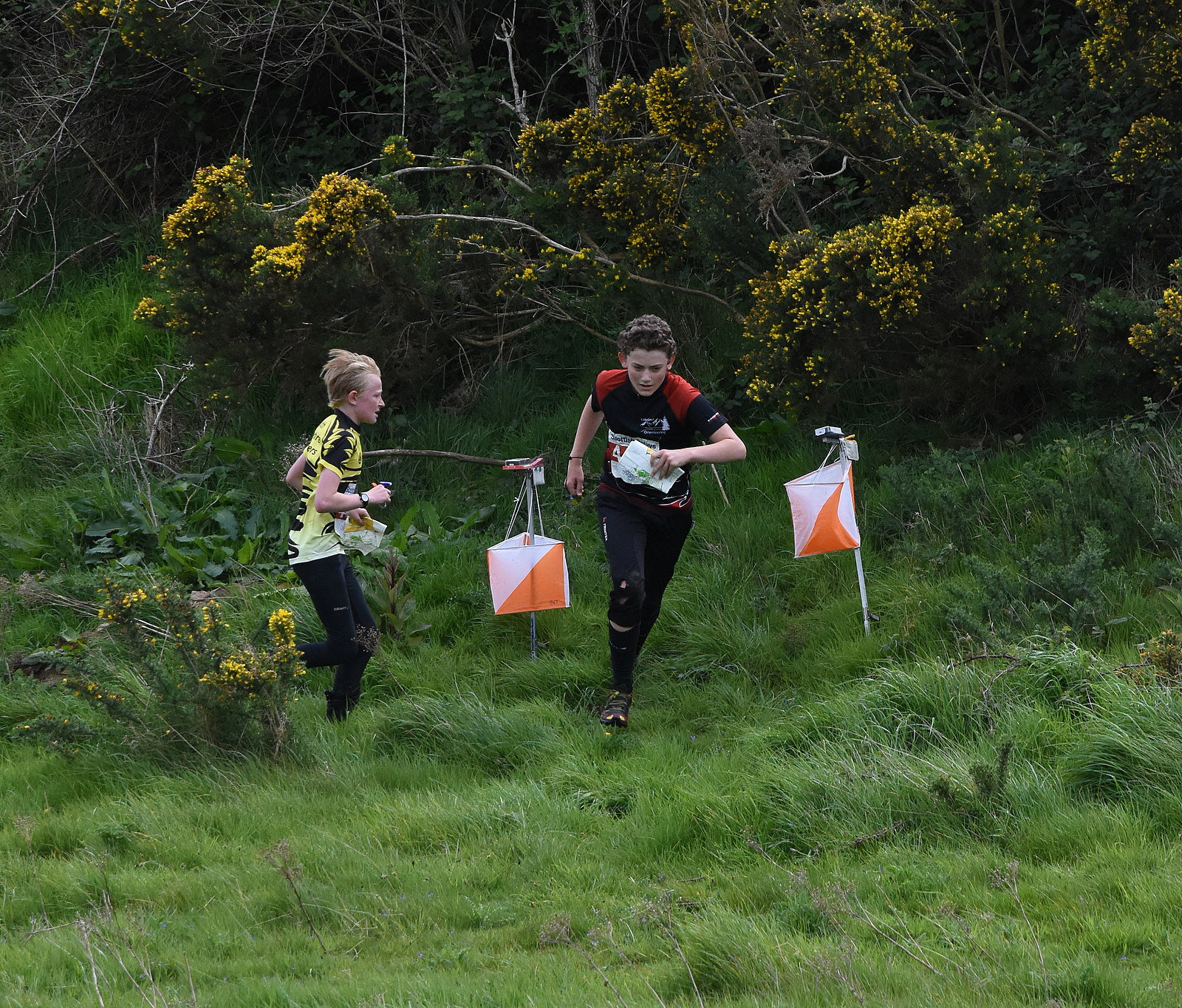

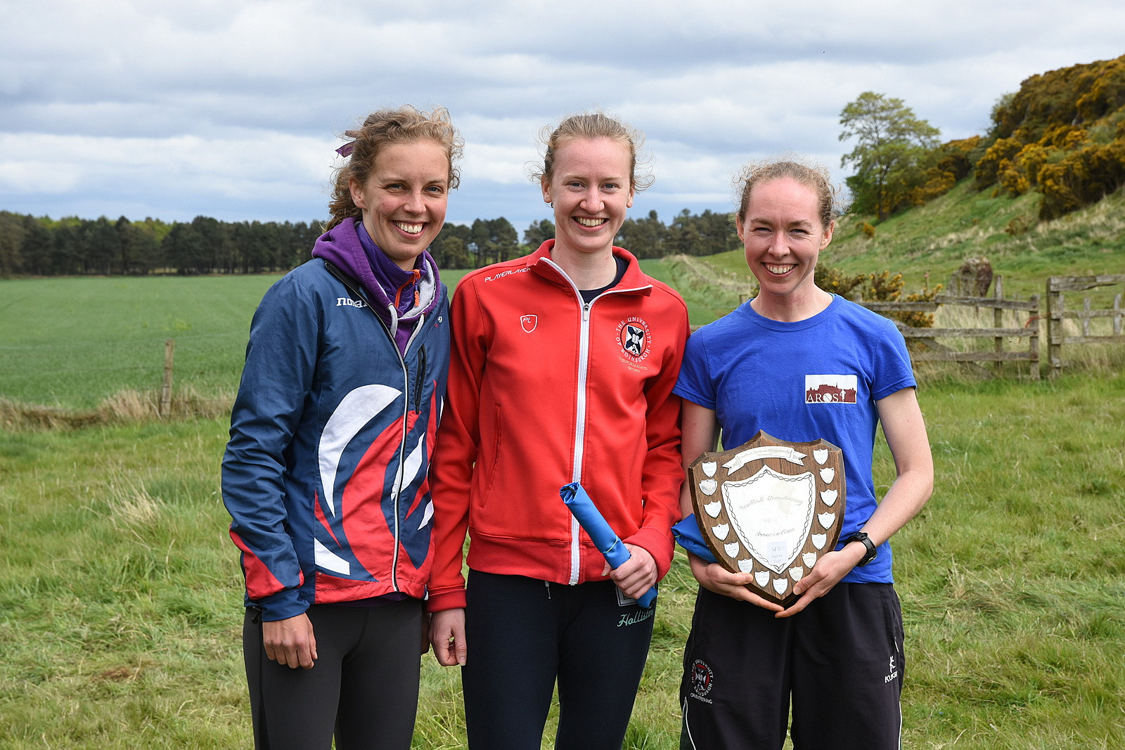
All photos by Crawford Lindsay; view more of the relay and prizegiving.
SOC 2017 List of winners
SOC 2017 Individual results
SRC 2017 results
SRC 2017 Combined handicap results
Individual race
Organisers’ Comments
With the complexities of this event it is only right we acknowledge those who helped set it up and gave permissions for access and use.
Graeme Ackland, Interløpers, SOC 2017 co-ordinator.
Max Carcas, Interløpers, arranged initial land use, introduced us to the various landowners and land managers and was invaluable in dealing with our many queries.
Stuart Duff, Gullane Golf Club.
Paul Seago, Renaissance Golf Club.
Ian Everard, Archerfield Golf Club.
Stuart McEwen and Colin Irvine, Muirfield Golf Club.
Elly Douglas-Hamilton and Ross McGregor, Archerfield Walled Garden.
East Lothian Council, including their ranger service, Jen Newcombe, John Harrison, David Wild and Neil Clark.
Mike Thornton, Scottish Natural Heritage.
Their help and co-operation was exceptional.
Thanks too, to Coast Medical for their presence. The extent of their professional involvement was the issue of one elastoplast!
Thanks to Rick Houghton, Compass Point for his attendance.
Many were a little surprised when Archerfield was again linked with orienteering given the huge changes since its use for competition from almost 30 years ago. We realised early on that Archerfield Estate would only provide TD 1&2 terrain, and we’d need to make full use of all available surrounding areas. This meant the split starts for Red and Blue with one finish.
The actual organisational challenges we feel were satisfactorily dealt with, especially manning over the whole area, including the road crossings for safety.
The event generally was very positively received and thanks to everyone for attending.
Thanks to the many friends and helpers, not just in Tay and ESOC, who helped to stage this event. Thanks also to Robin Strain for his assistance with SI at the Individual event.
Orienteering isn’t a perfect sport; there are one or two issues we continue to deal with.
Anne Thom & Ewart Scott. ESOC.
Planner’s Comments
Firstly, I hope you all enjoyed your day in the rain. It was the only rain I saw in six months of planning.
Having read a lot of the feedback, various blogs and social media sites a short bit of background is required.
The Event effectively, as you will all have noticed, consists of three areas: Gullane, Yellowcraigs and Archerfield. The first two were stitched together to provide both variety and length for the M21E. The latter so we could provide compliant junior courses. Some people liked the coastal stitch and some didn’t and I shall put my hand up for the wrong control placement at 213 which hopefully only affected a small minority of competitors. I returned to the area yesterday after the Relays to assess the site.
I won’t go on about the courses as they were compliant and I would like to think made the most of a good area that came with access restrictions in place. I refrained from covering significant sections of the map as out of bounds as that would have spoiled the presentation. What is worth mentioning is the amount of person hours that goes into putting on these high stature events with all the negotiations and third parties one gets involved with as the Planner.
The Start positions, finish locations and the logistics of providing the courses rely heavily on successful negotiations and making the most of what is made available for one to work with. They weren’t where they were by accident. Courses 1 to 4 were at Yellowcraigs to make the most of some tricky areas of great variety, provide length and scope of terrain and lastly to justify a remapping of all of the competition areas. The other non-junior courses made best use of the North Gullane area. This allowed a lot of the shorter TD5 courses to be in an area that one normally never sees when the centre is based at Gullane village. Junior courses were provided with a brand new area, freshly mapped, around the Archerfield Estate and Event centre.
Putting this Event out was a logistical challenge with a lot of effort utilising limited resource. I can’t thank the volunteers, who know who they are, enough for the time and effort they put into this along with myself.
I look forward to all of the young talent coming through who will take the Sport to a new level and be next year, or the year afters, Planner. That’s 2.5 Scottish Championships I have planned or been assistant Planner on. Many thanks to those of you who gave me kind remarks after the Event. It still amazes me how fast some people of any age you care to pick on can get through the tussock and tree roots of Gullane. Hopefully those of you who didn’t know East Lothian will be inspired to come back in the future for some more.
Mike Stewart ESOC
Controller’s Comments
Controlling the Scottish Championships, presented a number of challenges, not least being the extent of the area from Yellowcraigs in the North to Gullane Bents in the South. In addition, the White and Yellow courses were on a totally separate map at Archerfield. It was a pleasure to work with such competent people, in particular Mike Stewart the Planner and Anne Thom the Organiser. They managed to cope with particularly complicated access negotiations and the logistics of four starts and two finishes, some of them a long way from assembly.
I heard many good comments about Mike’s courses; they provided a good test of navigation and ability to cope with varying terrain. The narrow shape of the available area meant that a very large number of controls were needed on the longest courses. Because of the limitations of the area, the fact that a 1:15000 map would have been illegible, and the remote finish, we took the decision to grade the event as Level B rather than Level A.
The map was generally pretty good and the sand dunes were well represented. However the mapping of the vegetation was not entirely consistent and the individual trees mapped as white blobs were pretty much invisible on the map.
The four controls on the shore below the High Water Mark were always going to have some risk attached. They couldn’t be tagged and could only be placed at the last minute which severely limited the opportunity for checking them. They were only used by the longest courses where parts of the terrain were linked by runs along the beach. I’m very sorry that control 213 (used by Courses 2 and 3) was wrongly placed, being about 50m east of its proper location. It was visible from the correct location and most people quickly found it though a few lost up to about 3 minutes.
Finally, I think congratulations are due to all (both competitors and officials) for coping cheerfully with miserable weather for most of the day.
Relay
Planner’s Comments
The first choice for the relay was to do both days on Gullane, but once we lost permission for the southern extension this became unviable. Second choice was a bijou relay on Yellowcraigs. Probably two laps would be needed. But when we lost even more of Gullane we needed that to for the individual. Third choice was Riccarton, but the idea of an urban relay got slapped down. Fourth choice. Binning.
After the ELO event there in September was not universally well received, the queue for the planning job was zero, so I took it on. The ongoing rhodo work meant delaying the planning until very late, and the main rationale was to funnel the courses through the nice bits, continually changing the required orienteering style. A bit of gardening and ungardening created the control pick in the little maze of paths and the final loop gave something for spectators to watch.
The handicap was mighty close as always, Tullie just taking Musgrave on the last loop, with the Maroc Juniors a minute clear. Women’s open had the lead change hands repeatedly with 9 teams finishing within 10 minutes. Men’s open was a bit more of a parade, with EUOC hitting the front on leg 2 and never looking threatened.
It was never going to be like planning WOC on Darnaway, but generally pretty pleased with how it went. The gaffling was simple, but with enough crossovers that following was never safe. The D course was a tad too long, deliberately so to get the maximum time in the nicest but far away bit of wood (winner still ran sub-29). I took the decision not to gaffle yellow and orange and the absence of DQed children makes me happy.
Thanks are due to many people, but especially to Mikey and EUOC for grabbing my all-controls map and collecting everything in next to no time, and to Trina for sorting access and permissions with relentless calm (if that’s a thing).
In a year or so the rhodo cuttings will be gone, but there’s already evidence of regrowth. If that gets sprayed this year the wood could become a gem. If not, this may be the orienteering highpoint.
Graeme Ackland, INT